Every POTA Park in EM50 and EM60, by State
Every POTA park in grid squares EM50 and EM60, grouped by the state you would drive to — and flagged where the park’s published coordinate is close enough to a grid line that it is worth checking your grid before you upload the log to POTA. That last part is what this page is really for. The park list itself is public; which parks sit near a line is not, because working it out means measuring every published coordinate against the grid boundaries.
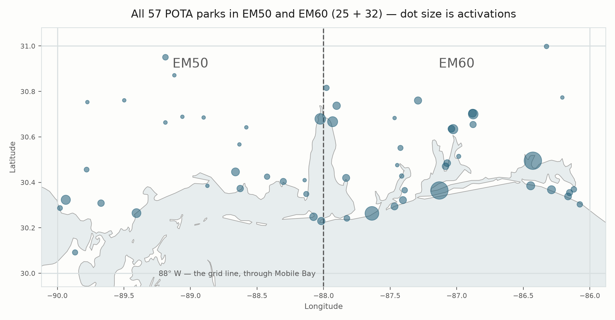
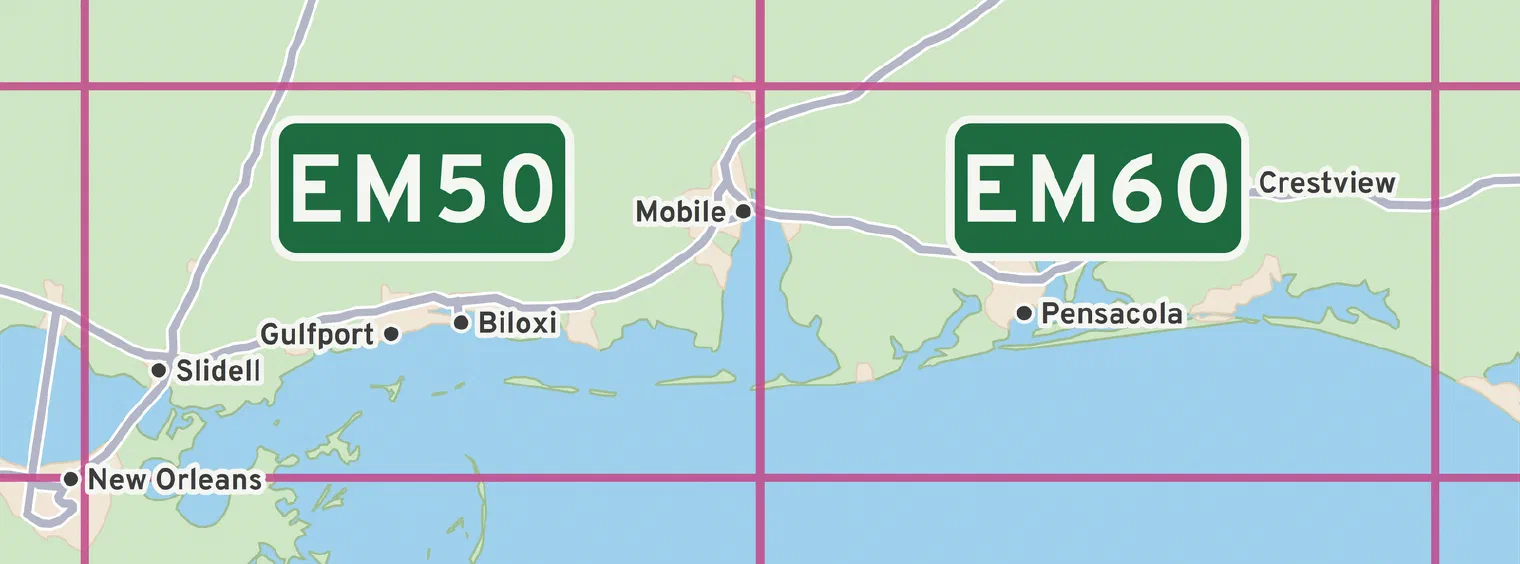
EM50 and EM60 are neighbours. Each Maidenhead square is two degrees of longitude by one of latitude, so together they cover 86° W to 90° W and 30° N to 31° N — the coast from eastern Louisiana, across south Mississippi and Alabama, into the Florida panhandle. The line between them runs down 88° W, straight through Mobile Bay.
Everything below comes from POTA’s own public record and refreshes overnight. No park is added, ranked or described by hand — the rows are generated from POTA’s own endpoints on a schedule — and there is nothing to sign up for.
As of 2026-10-09T07:51:17Z — 57 parks across EM50 and EM60. Refreshed overnight: the figures update about 02:50 US Central and the page rebuilds every few minutes after that.
Reading the Counts
Two things about the numbers on this page, both worth knowing before you use them.
The state counts add up to more than 57. 2 of these parks are genuinely in two states at once, and they appear under each one rather than being assigned to whichever is bigger:
- US-0661 Gulf Islands National Seashore — US-FL,US-MS
- US-0384 Grand Bay National Wildlife Refuge — US-AL,US-MS
So the four state totals below sum to 59, not 57. That is the straddlers being counted twice, not a park missing or double-listed by mistake.
Activation counts are a floor, not a total. POTA only counts an activation once the operator uploads the log, and an activation needs ten contacts — below that it is an attempt. Somebody could have worked a park last weekend and not uploaded the log to POTA yet, so read every figure here as "at least this many." They usually rise as logs arrive; a corrected or withdrawn log can move one down.
Where One Coordinate Isn't Enough
POTA publishes a single point for each park and never publishes the park's outline. That one point is what every grid figure on this site rests on, and there are two quite different ways it can mislead you. Both are worth knowing before you drive somewhere and log a square.
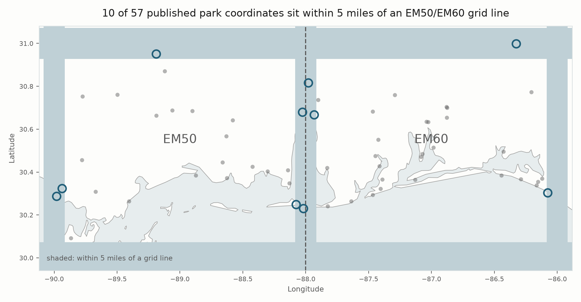
Published coordinate near a grid line (10 parks)
These are the parks whose published point falls within 5 miles of a grid boundary. That is a reason to check your grid at the operating position — not proof that the park crosses the line.
Two kinds of line show up here, and they fail differently:
- 88° W — the line between EM50 and EM60. Set up on the wrong side and you have logged the neighbouring square. Both count for this site's boards; they are different squares to anyone chasing grids.
- An outer edge (90° W, 86° W, 30° N, 31° N) — the outside of both squares. Set up beyond one and your park activation is still perfectly valid, but the contacts land in a neighbouring square rather than in EM50 or EM60, even though the park still appears on this site's boards.
| Park | Name | Grid | State | Distance | To | Map |
|---|---|---|---|---|---|---|
| US-1040 | Lake Jackson RV Park at Florala State Park | EM60ux | US-AL | 0.1 mi | 31° N (outer edge) | map |
| US-0025 | Fort Morgan National Historic Site | EM50xf | US-AL | 1.0 mi | 88° W (EM50/EM60) | map |
| US-6445 | St. Tammany Wildlife Refuge | EM50ag | US-LA | 1.2 mi | 90° W (outer edge) | map |
| US-3699 | Mobile-Tensaw Delta Wildlife Management Area | EM60at | US-AL | 1.3 mi | 88° W (EM50/EM60) | map |
| US-11376 | USS Alabama Battleship Park | EM50xq | US-AL | 1.5 mi | 88° W (EM50/EM60) | map |
| US-4494 | De Soto National Forest | EM50jw | US-MS | 3.4 mi | 31° N (outer edge) | map |
| US-0300 | Big Branch Marsh National Wildlife Refuge | EM50ah | US-LA | 3.8 mi | 90° W (outer edge) | map |
| US-1047 | Meaher State Park | EM60aq | US-AL | 4.0 mi | 88° W (EM50/EM60) | map |
| US-0042 | Fort Gaines National Historic Site | EM50xf | US-AL | 4.5 mi | 88° W (EM50/EM60) | map |
| US-1854 | Deer Lake State Park | EM60xh | US-FL | 4.5 mi | 86° W (outer edge) | map |
About that 5-mile cutoff. It is a chosen number — roughly how far apart two sensible operating spots can sit inside one large coastal park. A more principled rule does exist and was weighed: one Maidenhead subsquare per axis, which is about 5 miles against the meridians but only 2.9 against the parallels, since a subsquare is 5 minutes of longitude and 2.5 of latitude. Against real data that two-number rule changes exactly one row, so one legible number was kept instead — a trade, stated, rather than a claim that no principled option existed. Distance alone is also an incomplete way to sort this: a point 5 miles out in a thirty-mile wildlife management area is more worth checking than a point a mile out at a small historic site, and this table cannot tell them apart because park size is not published. Nothing just outside the cutoff is hidden — the nearest park left off is 5.8 miles out.
Parks one coordinate cannot represent (2 parks)
POTA's own record puts these parks in more than one state. That is POTA saying the reference covers ground in two places, which a single coordinate cannot describe. Measuring from that coordinate does not help here either — it can sit deep inside one square while other ground under the same reference sits in another, so the distance is small, reassuring and beside the point. How far apart the pieces are varies, and the two here are not the same shape at all.
| Park | Name | Published grid | States | Activations |
|---|---|---|---|---|
| US-0661 | Gulf Islands National Seashore | EM60ki | US-FL,US-MS | 1,306 |
| US-0384 | Grand Bay National Wildlife Refuge | EM50sk | US-AL,US-MS | 109 |
Gulf Islands National Seashore is the sharp case, and it is also the busiest park in these two grids. Its published coordinate is EM60ki, near Pensacola. The National Park Service runs a Mississippi District of the same seashore — Davis Bayou at Ocean Springs, and the Ship, Horn and Petit Bois islands. Those sit on the Mississippi coast, which runs west from the state line near 88.4° W and lies between 30° N and 31° N. West of 88° W and inside that latitude band is EM50. So one reference covers ground in both squares this site is about, its published point sits roughly fifty miles from the line between them, and no amount of measuring that point would have told you so.
Grand Bay National Wildlife Refuge is the mild one, and the contrast is the useful part. POTA lists it in both Alabama and Mississippi, but down on the coast that state line runs near 88.4° W — so both sides of it, and the published coordinate, sit comfortably inside EM50 at this latitude. Two states here is not two grids. A reference in two states is a flag to check, not a verdict.
If you activate a multi-unit park, read the grid where you are actually standing.
The short version. Every distance on this page describes a coordinate, never a park. Use the first list as parks worth a second look and the second as parks where the published grid answers a narrower question than you are asking. If the square matters to your log, take it off your radio or phone at the operating position.
Every Park, by State
West to east — the order you would drive this coast. Within each state, busiest first. A ± marks a park whose published coordinate is within 5 miles of a grid line.
Louisiana — 5 parks
| Park | Name | Grid | Activations | Outings | QSOs | Map |
|---|---|---|---|---|---|---|
| US-0300 | Big Branch Marsh National Wildlife Refuge ± | EM50ah | 281 | 286 | 12,773 | map |
| US-4071 | Pearl River Wildlife Management Area | EM50dh | 149 | 153 | 5,165 | map |
| US-0298 | Bayou Sauvage National Wildlife Refuge | EM50bc | 97 | 100 | 3,808 | map |
| US-6445 | St. Tammany Wildlife Refuge ± | EM50ag | 84 | 85 | 4,236 | map |
| US-0302 | Bogue Chitto National Wildlife Refuge | EM50ck | 81 | 86 | 3,660 | map |
Mississippi — 15 parks
| Park | Name | Grid | Activations | Outings | QSOs | Map |
|---|---|---|---|---|---|---|
| US-0661 | Gulf Islands National Seashore | EM60ki | 1,306 | 1,363 | 46,589 | map |
| US-2532 | Buccaneer State Park | EM50hg | 265 | 270 | 11,591 | map |
| US-0388 | Mississippi Sandhill Crane National Wildlife Refuge | EM50qk | 230 | 236 | 6,709 | map |
| US-2551 | Shepard State Park | EM50qi | 146 | 153 | 5,071 | map |
| US-4494 | De Soto National Forest ± | EM50jw | 117 | 118 | 6,169 | map |
| US-0384 | Grand Bay National Wildlife Refuge | EM50sk | 109 | 113 | 5,100 | map |
| US-7110 | Little Biloxi Wildlife Management Area | EM50jp | 49 | 51 | 2,185 | map |
| US-7635 | Airey Lake State Recreation Area | EM50lq | 43 | 43 | 1,545 | map |
| US-7112 | Ward Bayou Wildlife Management Area | EM50qn | 38 | 38 | 1,415 | map |
| US-8517 | Flint Creek State Recreation Area | EM50ku | 32 | 32 | 784 | map |
| US-7107 | Theodore Mars Wildlife Management Area | EM50gs | 28 | 29 | 744 | map |
| US-7108 | Pascagoula River Wildlife Management Area | EM50rp | 28 | 28 | 967 | map |
| US-7111 | Red Creek Wildlife Management Area | EM50nq | 25 | 25 | 745 | map |
| US-7109 | Old River Wildlife Management Area | EM50cs | 18 | 19 | 552 | map |
| US-9849 | Deer Island Coastal Park | EM50nj | 17 | 17 | 1,030 | map |
Alabama — 17 parks
| Park | Name | Grid | Activations | Outings | QSOs | Map |
|---|---|---|---|---|---|---|
| US-1042 | Gulf State Park | EM60eg | 645 | 681 | 33,883 | map |
| US-11376 | USS Alabama Battleship Park ± | EM50xq | 399 | 418 | 26,127 | map |
| US-1047 | Meaher State Park ± | EM60aq | 356 | 364 | 17,746 | map |
| US-0042 | Fort Gaines National Historic Site ± | EM50xf | 200 | 214 | 6,920 | map |
| US-11292 | Historic Blakeley State Park Historic Site | EM60br | 197 | 207 | 8,677 | map |
| US-0025 | Fort Morgan National Historic Site ± | EM50xf | 192 | 204 | 6,326 | map |
| US-3711 | Weeks Bay Reserve National Conservation Area | EM60ck | 172 | 176 | 6,380 | map |
| US-3691 | Grand Bay Savanna Complex Wildlife Management Area | EM50uj | 142 | 148 | 5,132 | map |
| US-0136 | Bon Secour National Wildlife Refuge | EM60cf | 127 | 135 | 3,231 | map |
| US-3699 | Mobile-Tensaw Delta Wildlife Management Area ± | EM60at | 110 | 113 | 6,125 | map |
| US-0384 | Grand Bay National Wildlife Refuge | EM50sk | 109 | 113 | 5,100 | map |
| US-3692 | Heron Bay and Portersville Bay State Fish and Wildlife Area | EM50wi | 103 | 104 | 3,957 | map |
| US-3696 | Lillian Swamp Complex Preserve State Conservation Area | EM60hk | 70 | 77 | 2,200 | map |
| US-1040 | Lake Jackson RV Park at Florala State Park ± | EM60ux | 68 | 69 | 2,755 | map |
| US-12996 | Fowl River Access Site BLM Recreation Management Area | EM50wj | 57 | 57 | 2,460 | map |
| US-3700 | Perdido River Wildlife Management Area | EM60gq | 43 | 43 | 1,524 | map |
| US-9916 | Blackwater River State Nature Preserve | EM60gl | 28 | 28 | 836 | map |
Florida — 22 parks
| Park | Name | Grid | Activations | Outings | QSOs | Map |
|---|---|---|---|---|---|---|
| US-0661 | Gulf Islands National Seashore | EM60ki | 1,306 | 1,363 | 46,589 | map |
| US-1873 | Fred Gannon Rocky Bayou State Park | EM60sl | 1,054 | 1,070 | 48,981 | map |
| US-4614 | Blackwater River State Forest | EM60nq | 317 | 331 | 14,458 | map |
| US-8327 | Blackwater River State Conservation Area | EM60lp | 288 | 294 | 12,347 | map |
| US-1876 | Henderson Beach State Park | EM60sj | 224 | 234 | 9,508 | map |
| US-3664 | Topsail Hill Preserve State Park | EM60ui | 221 | 233 | 10,130 | map |
| US-1841 | Blackwater River State Park | EM60nq | 215 | 220 | 9,975 | map |
| US-1837 | Big Lagoon State Park | EM60hh | 191 | 211 | 6,604 | map |
| US-8332 | Escambia River State Conservation Area | EM60is | 183 | 189 | 8,697 | map |
| US-1910 | Perdido Key State Park | EM60gh | 174 | 180 | 5,011 | map |
| US-1875 | Grayton Beach State Park | EM60wi | 160 | 171 | 6,151 | map |
| US-3670 | Yellow River Marsh Preserve State Park | EM60ll | 158 | 162 | 7,511 | map |
| US-3608 | Blackwater Heritage State Trail | EM60lp | 156 | 162 | 5,345 | map |
| US-8333 | Garcon Point State Conservation Area | EM60kl | 150 | 153 | 5,184 | map |
| US-8335 | Yellow River Water Management Area | EM60np | 139 | 142 | 5,136 | map |
| US-4636 | Point Washington State Forest | EM60wi | 130 | 136 | 4,499 | map |
| US-1861 | Eden Gardens State Park | EM60wi | 108 | 114 | 2,905 | map |
| US-3662 | Tarkiln Bayou Preserve State Park | EM60hi | 108 | 126 | 3,272 | map |
| US-1854 | Deer Lake State Park ± | EM60xh | 102 | 109 | 3,202 | map |
| US-8334 | Perdido River State Conservation Area | EM60gn | 95 | 98 | 2,683 | map |
| US-6300 | Escribano Point Wildlife Management Area | EM60mm | 63 | 68 | 2,388 | map |
| US-13011 | Shoal River Headwaters State Park | EM60vs | 46 | 46 | 1,049 | map |
Pick One and Go
The most useful thing on this page is the bottom of each state table. A park with single-digit activations is one somebody has barely touched, and every one of them is open to you this weekend. Nothing to join, nobody to tell — pick a park reference above, work ten contacts, upload the log to POTA when you get to it, and the next overnight refresh picks you up on its own. Nothing comes to us; this page is built from POTA's public data. If you pick one marked ±, or one of the multi-state parks above, read your grid where you actually set up before you upload to POTA.
Rankings and totals for these grids are on the POTA Leaderboards page, and who is on the air right now is on Active Now.
Notes on Sources
Where the parks come from. The 57 references are the union of what POTA's own per-grid endpoint — the one behind their map — returns for EM50 and for EM60, counted once each. Grid membership is POTA's answer, not ours: this page asks POTA which parks are in each grid rather than deciding for itself from coordinates. State, name and coordinates come from POTA's US park list, and the two sources are reconciled on every refresh. The stated rule if they ever disagree about membership is that the grid endpoint wins and the disagreement is reported rather than silently resolved — stated rather than demonstrated, because the two sources have not yet disagreed on any refresh. A park POTA lists but whose detail cannot be read is named on the page rather than dropped.
Where the distances come from. Computed here, from POTA's published coordinates against the Maidenhead boundaries of EM50 and EM60 — POTA does not publish these. Distance to a meridian (90° W, 88° W, 86° W) uses the difference in longitude, converted with the cosine of each park's own latitude rather than a fixed figure; at 30.5° N that is the difference between about 60 and about 69 miles per degree. Distance to a parallel (30° N, 31° N) uses the difference in latitude alone. A park with no published coordinates gets no distance at all rather than a guessed one, is never flagged, and is not plotted on the map — the map says so in its own output when it happens. The arithmetic is covered by the generating script's offline test suite, including a park sitting exactly on the divide, a park whose nearest line is an outer edge rather than the divide, and a park with no coordinates.
What is not here. Park outlines, because POTA does not publish them. Anything about who activated what — that is the leaderboards page, and this one deliberately names no operators. Stats via POTA.app.